Senegal is an example of a low-income country, highly invested in achieving the SDGs (République du Sénégal, 2018). It borders five countries and its position as a stable stronghold of democracy and security in the West African region, places it of high strategic global interest.
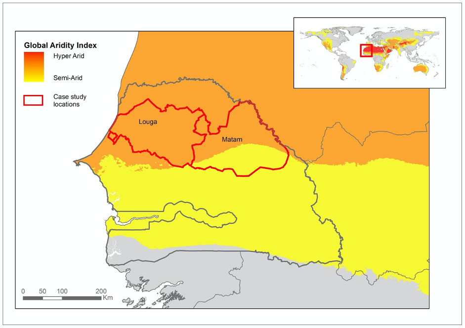
The focal study area in Senegal englobes the administrative regions of Louga and Matam in the north of the country. The central portion of the area is a silvopastoral zone, largely dedicated to extensive livestock herding integrating livestock, forage, and trees. The area faces multiple challenges, including low and sporadic rainfall, and increasing human pressure on natural resources. Water is the major challenge, accessible via deep boreholes that are multiplying rapidly, contributing to anarchical settlements and land degradation.
Towards the west, rain-fed agriculture increases, consisting mainly of peanuts for consumption and export, and along the coast, there is irrigated small-scale vegetable farming. Expansion of large-scale rice farming is promoted, further exacerbating age-old agriculture-pastoralism conflicts. The western part of the study area has a fishing industry along the Atlantic coast for exportation. There is also freshwater fishing around the Lac de Guiers, which constitutes the major freshwater source for Dakar and takes its source from the Senegal river, the major rice production zone of Senegal, and the natural border with neighboring Mauritania.
The Senegalese part of the Great Green Wall for the Sahara and the Sahel Initiative is located in the study area (Goffner and Sinare et al 2019). This means that there are significant investments in the area against land degradation and openness to transdisciplinary knowledge production among actors in the region.
Comments